The industry-first mobile SLAM LiDAR scanner was launched on February 16 and is expected to cut site survey time by up to 95%.
Emesent, a trailblazer in autonomous mapping technology, is gearing up to present its latest offering, the Emesent GX1, at CONEXPO-CON/AGG 2026.
The tech company, which was established in 2018 by two Australian researchers from the prestigious Commonwealth Scientific and Industrial Research Organisation, officially launched its Simultaneous Localization and Mapping (SLAM) and Real-Time Kinematic (RTK) scanner on February 16 at Geo Week.
The Emesent GX1 is an all-in-one, SLAM LiDAR, RTK 360°-imaging mobile scanner that aims to reduce site survey time for surveyors by up to 95% and deliver results with 5-10 mm accuracy across a broad range of environments.
Designed to be user-friendly, precise, and accessible to junior and experienced surveyors, the device promises to finish complex scans in hours, freeing up time and allowing teams to take on more projects.
LiDAR, integrated RTK, 4x20MP cameras, and advanced software come together to deliver a seamless experience via the Emesent GX1, which utilizes Aura and Aura Cloud to provide enhanced data visualization, uninterrupted shareability, and easy cloud access.
“With the introduction of the GX1, we’ve answered the call we’ve heard echoing throughout the surveying industry to end the tug-of-war between fast and accurate,” said Dr. Stefan Hrabar, Chief Strategy Officer and Co-Founder of Emesent. “By putting the power of SLAM into the hands of the everyday surveyor, the GX1 raises the bar for mobile scanning accuracy and keeps critical projects on track.”

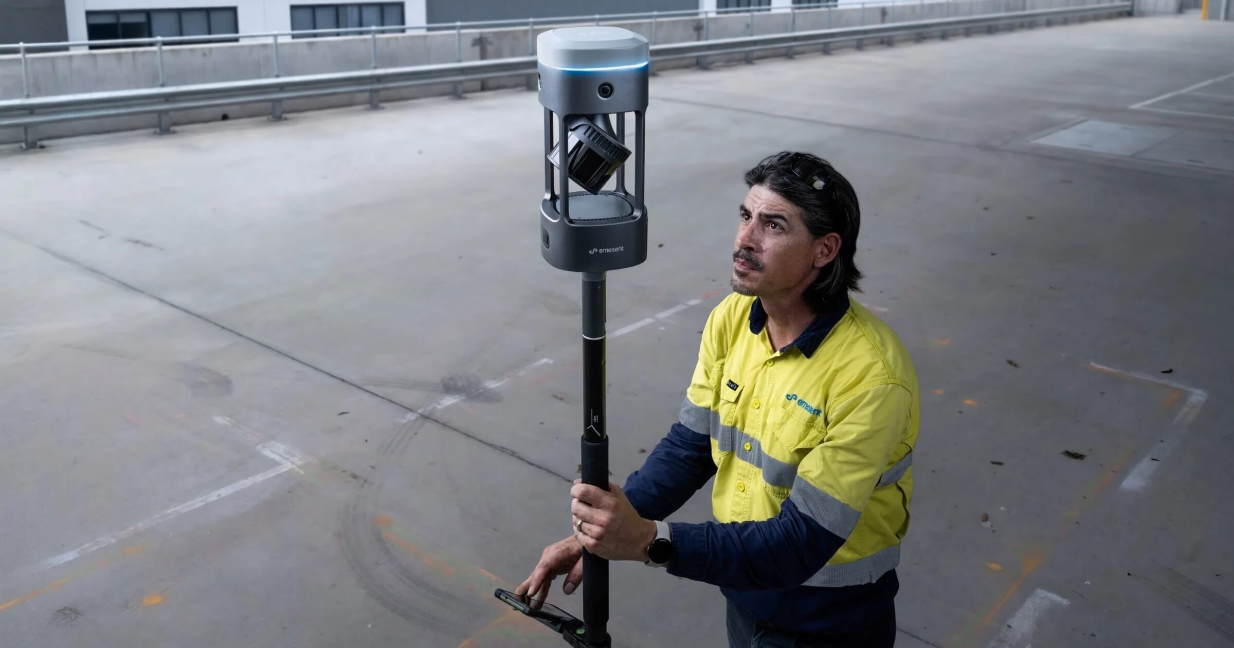
Emesent GX1 mounted to a backpack. It can also be deployed as a handheld scanner; attached to a vehicle or pole; or lowered in a cage. Photo courtesy of Emesent.
The company, known for crafting innovative 3D data capture, processing, and visualization solutions for various clients across the AEC industry, has also designed the Emesent Hovermap, an award-winning smart mobile scanning unit.
According to the Emesent website, the device provides AI-powered autonomous mapping and advanced LiDAR sensing to deliver comprehensive, survey-grade data across expansive areas. Equipped with a sensing range of up to 300 meters and the ability to capture more than a million points per second, the Hovermap is designed to collect detailed, accurate data faster than many traditional survey methods.
It also offers more precise measurements and clear 3D models through Emesent’s SLAM technology, automated ground control points, and a high-resolution LiDAR sensor. The Hovermap has been used to capture data from sites like the Alcatraz Island in California and the Carrapateena mega cave in South Australia.
To stay connected and find out about the latest releases from Emesent and other companies at CONEXPO-CON/AGG 2026, follow us on LinkedIn and subscribe to our weekly newsletter.